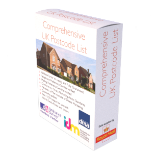
Postcodes List – United Kingdom (UK)
This instant download covers every known Postcode (circa. 1.79 million) within the UK. The file shows full Postcodes (e.g. LN9 6QZ), Postcode Sectors (e.g. LN9 6), Postcode Districts (e.g. LN9) and Postcode Areas (e.g. LN). We have also included a 2nd list of circa. 892,441 ‘retired’ postcodes that are no longer in circulation. Postcodes within the file are updated quarterly to ensure they remain current, and our clients receive an inclusive complete refresh every three months as part of the service, for no additional fee.
Applications
- Postcode Correction / Cleaning
- Eliminate invalid postcodes
- Reduce the amount of undelivered mail
- Preservation of brand image
- Form Registrations
Output
You’ll initially receive one compressed file (ZIP) which will decompress into two Comma Separated Variable (CSV) files, (1) the main list of active postcodes and (2) a second file showing postcodes that the Royal Mail have now retired / taken out of circulation. CSV files will open with most software applications, including but not limited to Excel, Word, Notepad, Access, SQL etc. If you require the data supplied in another format then we will be more than happy to try and accommodate you at no extra cost.
Data fields present within the product file:
- Full Postcode (e.g. LN9 6QZ)
- Postcode Sector (e.g. LN9 6)
- Postcode District (e.g. LN9)
- Postcode Area (e.g. LN)
- Date Postcode Introduced (201106)
- Date Postcode Retired (if applicable)
Coverage
This Postcode File contains approximately 1.79 million full Postcodes and broken this further, into, the Postcode’s Sectors, Districts and Areas; every known Postcode within the UK. In addition there is a further file containing circa. 892,441 retired postcodes. Other files available: England, Wales, Scotland, Northern Ireland, or Greater London.
Licensing
Downloads are supplied as licensed products, allowing unlimited reuse of the file content for 12 months. You may cancel the licence at any time without penalty. The licence fee you pay covers the considerable effort taken to compile and update the product, including our manual correction and verification, and finally verification against the latest Royal Mail and Ordnance Survey databases. On or before the 11th month, we will write to you, offering to extend the licence for a further 12 months or to let it expire.
Updates
As part of the fee paid, we will automatically send you a full product file refresher every 3 months for no additional fee. This will ensure the postcodes and associated content remains current.
Guarantees
We have developed internal quality processes to help ensure the data you purchase is fit for purpose. If you are for some reason not satisfied with the data or our work, we offer a no quibble refund in exchange for your feedback.
Buy now…
£129.00 – £684.00 / year
Instant Download: A link to the data, is emailed upon payment. We will also email a link to the updated version of this file every three months (included in the fee you pay).
Useful Information
Reviews
0 reviews for Postcodes List – United Kingdom (UK)
Only logged in customers who have purchased this product may leave a review.


There are no reviews yet.