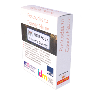
UK Postcode to County Names (Traditional, Administrative & Ceremonial)
This instant download contains all UK (circa. 1,791,295) Postcodes associated to a Traditional County name, Administrative County name, and Ceremonial County name. The product has been built using government body data including the Office for National Statistics (ONS), Royal Mail and Ordnance Survey. Also included are Royal Mail’s circa. 892,442 Retired Postcodes. The product files are updated quarterly to ensure they remain current, and our clients receive an inclusive complete refresh every three months as part of the service, for no additional fee. Output formats are Comma separated Variable (CSV), Microsoft Access and Microsoft Excel.
Postcode to County Applications
The list of Postcodes by County names is ideal for relating postcodes and address information to their relevant Traditional, Administrative and or Ceremonial County. The data is therefore essential for allocating customers or sales leads to sales areas which are defined by County or for assessing demand for County based local services, or for validating and or completing address elements in the data you hold already.
Administrative County
The Administrative County field provides the names of current administrative County areas. Where counties have been replaced by Unitary Authorities, Metropolitan Districts or London Boroughs, the names of those administrative areas have been provided instead.
Traditional County
Until 1974 the historic county names formed the “county” element in Post Office recommended postal addresses throughout most of the United Kingdom. However, in 1974, the Post Office changed the “postal counties” in Wales and some parts of England, basing the new ones on some of the new local government areas created in that year. Hence, such entities as “Avon”, “South Humberside” and “Dyfed” began to appear in postal addresses. However, these new “postal counties” were unpopular with many people and the historic county names have continued to be widely used in those areas affected. Furthermore, this policy was only applied to a part of the UK. In Scotland, Northern Ireland and much of England historic counties continued to form the “postal counties”. Ironically, all but one of the local authorities from which the new 1974 “postal counties” took their names were abolished within 22 years! Names such as “Clwyd”, “North Humberside” and “Cleveland” are now long since historically redundant. Meanwhile, of course, the historic counties in these areas continue to be important cultural and geographical entities. The lesson is clear. In areas such as postal addressing, it is clearly desirable to use a fixed geographical framework: one divorced from the very changing names and areas of administrative units but, instead, rooted in history, tradition, public affection and understanding. The historic counties provide this geographical framework and are the only sensible choice to use as the county element in postal addressing.
Retired Postcodes
Postcodes are terminated by Royal Mail for various reasons but most commonly it is due to the demolition/re-development of buildings or to postcode reorganisations. Terminated postcodes are occasionally re-used by Royal Mail but not usually before an elapsed period of two or three years. In such circumstances, all terminated postcodes and their grid references are retained and a ‘retired’ date is added which provides a clear indication of a postcode’s status.
Output
This product consists of three files, each with a header record. Output formats include Comma Separated Variable (CSV), Microsoft Access (ACC) and Microsoft Excel (XLS). CSV files will open in any common application including but not limited to MS Word, MS ACCESS, SQL and MS EXCEL. For the CSV formatted product, you initially receive one ZIP compressed file that when unpacked will reveal three files: (1) CTY-FLL-UK-CSV-1 contains all live Postcodes from Postcode Areas AB to LN (901,222 postcodes); (2) CTY-FLL-UK-CSV-2 contains all live Postcodes from Postcode Areas LS to ZE (890,074 postcodes); (3) CTY-FLL-UK-CSV-Retired contains circa. 892,442 Retired Postcodes.
Fields presented in the files:
- Fully Structured Postcode – e.g. B76 1PH
- Traditional County Name – e.g. Warwickshire
- Administrative County/ Unitary Authority Name – e.g. Birmingham
- Ceremonial County Name
- Country (England, Scotland, Wales or Northern Ireland)
- Date Postcode was Introduced
- Date Postcode was Retired (if applicable)
Coverage
United Kingdom (England, Scotland, Wales and Northern Ireland).
Licensing
Downloads are supplied as licensed products, allowing unlimited reuse of the file content for 12 months. You may cancel the licence at any time without penalty. The licence fee you pay covers the considerable effort taken to compile and update the product, including our manual correction and verification, and finally verification against the latest Royal Mail and Ordnance Survey databases. On or before the 11th month, we will write to you, offering to extend the licence for a further 12 months or to let it expire
Updates
As part of the fee paid, we will automatically send you a full product file refresher every 3 months for no additional fee. This will ensure the postcodes and associated content remains current.
Guarantees
We have developed internal quality processes to help ensure the data you purchase is fit for purpose. If you are for some reason not satisfied with the data or our work, we offer a no quibble refund in exchange for your feedback.
Buy now…
£150.00 – £1,200.00 / year
Instant Download: A link to the data, is emailed upon payment. We will also email a link to the updated version of this file every three months (included in the fee you pay).
Useful Information
Reviews
0 reviews for UK Postcode to County Names (Traditional, Administrative & Ceremonial)
Only logged in customers who have purchased this product may leave a review.


There are no reviews yet.